



The El Niño is here and it’s officially super! NOAA’s National Weather Service, which apparently still exists so far despite the Trump administration’s best efforts, has made a pronouncement.
The CPC Official ENSO outlook, which synthesizes multiple models from North America and abroad, indicates El Niño will continue to strengthen before beginning to weaken in early 2027. Chances for a historic event exceeding previous El Niños dating back to 1950 (+2.5°C or more for a 3-month RONI value) are now ~60% for the October-December and November-January periods, remaining at better than even odds. […] In summary, El Niño continues to strengthen, with a strong-to-very strong El Niño likely through January-March 2027 (remaining greater than a 79% chance).
The news hit me with a literal thunderclap yesterday morning, at about 4 a.m., when lightning actually woke me up to let me know that the “storm train” was pulling through. That’s not something that happens a lot around here in Southern California, especially in, oh God, November.
Officials say it might not stop at being a mere Super El Niño and it might even end up becoming a Super-Duper El Niño, which I think translates to “whoa hey, hold on to your fuckin hats, we don’t know what’s going to happen either,” but I’m not sure! All I can tell you is that there is a lot less of the West Coast than there was a couple months ago, when we didn’t have tremendous amounts of sea-level rise that may or may not be permanent, and we’re about to lose a lot more to storms and surges and rains and so on.
I may sound neurotic or alarmist here, and of course I’m not a climatologist so you can be forgiven if you think what I am saying about El Nino sounds like it’s over the top. Instead, I’ll hand the figurative microphone to actual climate expert Daniel Swain:
Water temperatures within about 20-30 miles of shore have reached exceptional, extraordinary, astonishing (running out of superlatives here) levels in recent days, and are now running more than 10°F warmer than average in a contiguous, unbroken region from Punta Eugenia in central Baja California northward to the Sonoma County coast (with “lesser” 5-8 degree anomalies continuing all the way up to the Oregon border). These values are unquestionably record-breaking, and have over the past week progressed even farther beyond that to become “record-shattering” in many areas: Not only are current ocean temperatures the warmest on record for the calendar date along the entire California coast (except for a small area near Crescent City), but they have now reached levels that would be record-breaking for any cool-season (Nov 1-Apr 30) week in the entire period of record (which begins with the satellite era in 1981) all the way from Newport Beach northward to Eureka.
“Never in our lifetimes has the water been this warm, this late in the season, along the California coast — and in many cases by a considerable margin,” he adds.
What? Oh, no, I’m fine, I’m just screaming internally. Also, check this shit out! It’s about this season? From the Union of Concerned Scientists:
But this is also a very important year: tidal cycles that peak every 4.4 years and every 18.6 years are both, unfortunately, expected to peak this year, bringing even higher king tides than usual. According to Patrick Barnard at UC Santa Cruz, this would result in an extra 2-4 inches of sea level rise this winter, on top of the already 1-2 feet increase from king Tides, with repeated peaks around Thanksgiving, Christmas, and MLK Day, around the successive full moons.
And don’t forget about my old friend the Kelvin wave! It’s still hanging around!

As if what the Super El Niño and the king tides and the tidal cycles are bringing to the table isn’t enough, another anomaly has logged on to the north: The polar vortex has experienced its regular bout of “sudden stratospheric warming” far earlier than anticipated this year, and in fact earlier than ever recorded, lumbering in like the worst party guest ever.
The polar vortex is a band of icy, low-pressure air that generally blows around the North Pole, kept in place by the jet stream. Anything that changes there can cause that arctic air to dip into warmer climates, causing freezing temperatures in places that don’t normally freeze, and the winds have just switched direction.
It’s normal though, so it should be fine, right?
“As far as we know, this is the earliest stratospheric vortex disruption that has been observed,” European Centre for Medium-Range Weather Forecast (ECMWF) principal scientists Tim Stockdale and Frederic Vitart told the AFP news agency.
The French meteorological agency Meteo-France, meanwhile, called it “an unprecedented event.”
The early breakdown of the vortex “really increases the chance of cold air outbreaks across the latitudes where most of the densely populated population centers are across the Northern Hemisphere, US, Europe and East Asia,” Judah Cohen, a climatologist at the Massachusetts Institute of Technology told AFP.
So if El Niño is warmer air caused by warmer water temperatures at the equators, and the Polar Vortex is colder air caused by weakening of winds at the poles, and these are record-breaking airs, what happens when those two airs meet?
However, it may be minimal, if we’re lucky. According to an interview Climate.US did with NOAA polar vortex expert Amy Butler, the effects of this particular polar incident may be relatively short, lasting perhaps a few weeks.
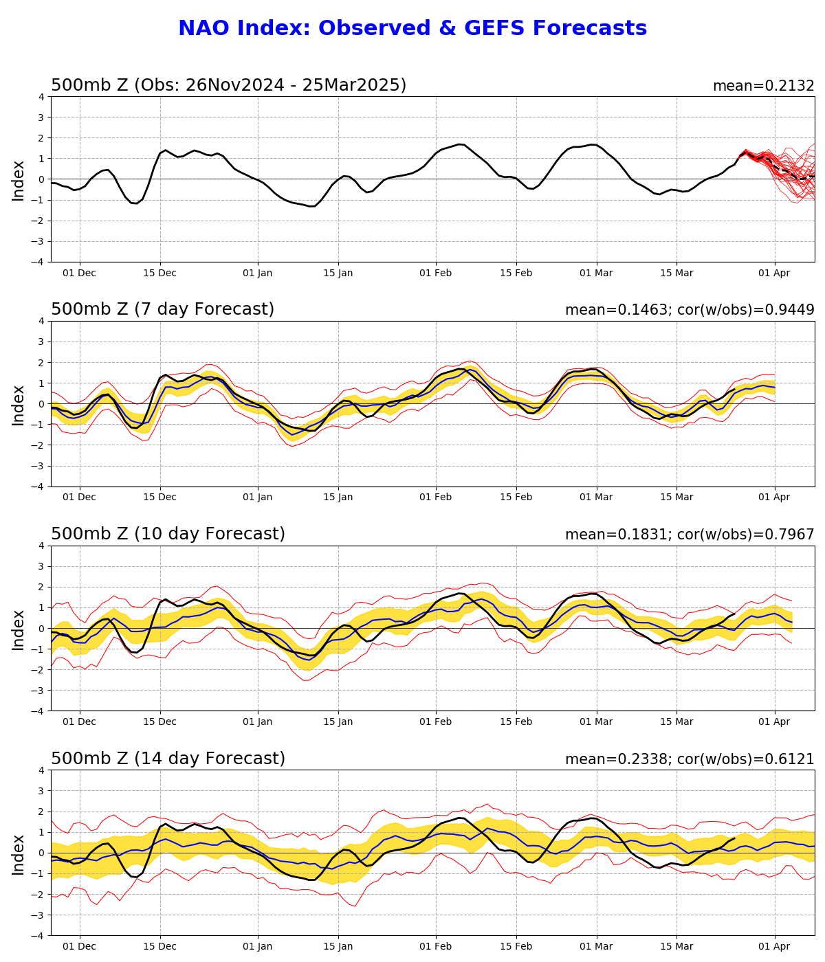
The North Atlantic Oscillation changed to its negative phase, as expected, but is forecast to return to near neutral values for the latter half of November. The typical SSW pattern of colder than normal weather over northern Europe, Asia, and the eastern US is apparent, though somewhat muted, for the next week or two, but then disappears. Over North America in particular, El Nino seems to have a strong grip on the temperature patterns over the next month at least, driving forecasts for much warmer than normal temperatures over the northern tier of the US and cooler temperatures over the southern tier.
Here’s hoping that it doesn’t get as bad and destabilizing, in all senses of the term, as it looks like it might! But forewarned is forearmed, or something like that, so here’s my advice to you and your forearms for the next couple of months depending where you are, latitudinally speaking.
El Niño territory: Make sure that the roof of where you live is reasonably sound if you can, have a planned route to leave in the case of an impending fire or flood. Pick up free sandbags and have a plan to use them. Get a good umbrella and galoshes. Don’t swim in, drink, drive across, or wade in floodwaters, no matter how funny it is. Don’t decide to start taking surfing lessons this December.
Polar Vortex territory: Have food and water on hand. Wear layers to stay warm. Don’t pay attention to those videos that always circulate when it’s freezing about how you can heat a whole house with a candle and a clay pot — that doesn’t work and it could set your house on fire. If El Niño’s warmth conquers the polar freeze, see item no. 1.
Good luck out there, friends! If you need me, I’ll be over here, screaming into the void.
OT: but I hate DJT
https://bsky.app/profile/stantaknows.bsky.social/post/3n2c4yib3lc2y
Trump has the kind of brain that thinks if you fire all the weathermen, it won't rain anymore . . .